OnXMaps for the Public Land Deer Hunter
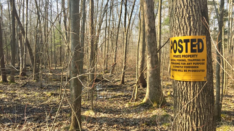
Ever been on public land deer hunting and been unsure where the boundary is and had to back out just as the sign is getting hot? Been driving and had a big buck cross the road and needed to know NOW if the property is public or private? Or, have you ever encountered private land owners posting no trespassing signs on public hunting land?
I encounter all of the above hunting Michigan public land, so I bought the OnX Hunting GPS maps chip for my Garmin.
Since purchasing the Michigan OnXMaps chip for my GPS, I now drive everywhere with my GPS on the dash zoomed out and regularly discover unmarked public land that doesn’t show on the Michigan DNR’s Mi-Hunt website. I scout, prep hunting spots, and hunt with confidence knowing exactly where property boundaries are. So now, when I get eyes on a mature deer I want to target, I check my OnX to determine if the parcel is public or private and immediately develop a game plan to get on the deer.
I do want to say that I’m not sponsored or supported by OnXMaps. Their product has simply been an awesome hunting tool and I want to share how it’s helped me.
OnXMaps offers hunt mapping apps for laptops, phones and SIM chips for GPS devices. With topographical overlays and property apps for all 50 states, it’s an awesome public land deer hunting and scouting tool. Their hunting GPS maps show property owner information and typically colors state owned property differently than private owned parcels and shows your location relative to property boundaries. The property owner information is great if you’re inclined to knock on doors for permission.
Uses for Private Land Deer Hunters
Few things will get you booted off private or create issues with neighbors faster than ending up in the wrong field or on the wrong side of a fence. If you have permission to hunt a farm with multiple properties or irregular borders, OnXMaps is invaluable. OnXMaps clearly shows parcel boundaries and the landowner’s name and your exact location in relation to the property boundaries. It’s a good idea to show the landowner the OnXMaps on your phone or GPS and show him his name on all of the parcels he owns. This effort will help you stand out to the landowner as a serious player and reassure him you won’t be wandering.
Advantages of OnXMaps for Michigan Public Land Deer Hunting
I spend a lot of time hunting Michigan public land for deer and grouse and almost every parcel I traverse borders or is surrounded by private land. Not all private land is posted, or worse, it’s posted well onto the public land as private. Public land is often shaded a different color so a quick glance at my GPS confirms I’m “on the right side of the fence.”
Because I always drive with my GPS on my dash, I’ve found many un-posted and landlocked public land hunting spots. Recently, while driving on a highway in northern Michigan, I passed by an awesome looking tag alder and cattail marsh. The highway ran along the transition from highland to lowland, so one side of the road was mature oak forest and the other side was the tag alder and cattail marsh surrounded by small homes and cottages. OnX showed the private parcels completely surrounding the several hundred acre marsh, but clearly showed the marsh as public land. Better yet, there was a stream that crossed under the road and ran right into the public land marsh. I love water access!

Having OnXmaps on my GPS helped me harvest this marsh buck in 2015.
I didn’t hunt it, but my buddy did. He slid a canoe into the stream on opening day, and shot a nice buck in the marsh before lunch. If you want to learn a LOT about how we find and hunt mature deer in marshes, check out our marsh hunting DVD. My buddy was confronted after his hunt by a neighboring landowner who accused him of trespassing. When confronted with the fact the land clearly showed public on his GPS and was accessed legally, the upset landowner backed down.
On another occasion, while scouting a public land river bottom funnel by boat, I arrived to see “no trespassing” signs on the riverbank. I checked my plat book to confirm that public land continued some distance from the water’s edge and ended at the steep transition to high ground. Turning on my GPS I walked through the marsh grass towards the property boundary marked by OnXMaps. Nearing the property border with my GPS fully zoomed in, I literally caught my rubber boot on an old property wire laying in the marsh grass. Standing there, I then could see the lines of row planted pines where wire had grown in, and further down the line, a grey piece of plywood nailed to a tree. In this case OnXMaps showed me the true property boundary, not the adjacent private landowner’s ‘interpretation’ of the boundary.
These are just a few examples of how OnXmaps have helped me scout and hunt smarter. So, if you’re like me and always on the hunt for public land with limited pressure or frequently find yourself way back in some place and wonder how to get out “legally”, I highly recommend checking out OnXMaps.
Hope this helps you guys!